|
Pelican Bay on a Hobie 18 A Father's Day to Remember By Bill Mattson |
The plan was a three day trip to Santa Cruz Island and back on a Hobie 18 beach catamaran. We would sail to Cueva Valdez anchorage on the first day, then to Pelican bay early on the second day to hike, and return to the mainland on the third day.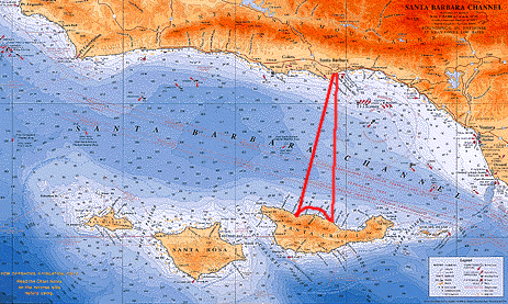 Map courtesy Channel Crossings Press Unlike the south shore, the beaches on the north shore of Santa Cruz Island are rocky. While we were equipped with small rollers and small sections of ABS pipe to serve as skids to move the boat on the rocks, a modest tide change was desirable. The best weekend for small tide changes was June 13th, so that was our planned date of departure. The planning for these trips can be daunting. Santa Cruz Island is completely primitive, with no services available. Besides getting the boat in top shape, equipment failure had to be expected and planned for with tools and spare parts. All clothing, food, and water had to be prepared and stored. GPS coordinates had to be recorded and programmed into GPS units. Weather had to be monitored closely up to the day of the trip. With work demands, a family commitment the night before our trip, and questionable weather, we called off our first attempt and delayed it until the following weekend. One advantage was that I would be taking this trip with my son on Fathers Day. One disadvantage was a 6 ft variance in the tides which meant a big move for the boat on the beach. As the day approached it was clear that this time we were ready to go. The night before the trip, a check of the weather showed gale warnings just west and south of our route. With Cueva Valdez being further west, and Pelican Bay being our primary destination, we changed our plan to sail directly to Pelican, and to attempt to get there by noon. After rising at 5 am, having breakfast, loading supplies, and getting to Santa Barbara Harbor, it was 6:45 am. Rigging and loading the boat took just over 2 hours, and we left the dock at 8 am under very light wind. In the light conditions it took nearly an hour to get to the harbor entrance. After a very slow sail about a mile out of the harbor the wind picked up enough for me to notice that the mast was not rotating properly. It dawned on me that I had neglected to remove the mast stepping pin, and told Thomas to go forward and get it out. This thing is jacked, he said. I had not inserted it properly when we rigged the boat, missing the hole on one side of the mast base, and bending the end of the pin when I had raised the mast. Now, I thought I could pound the pin free, using a wrench as a punch, and my 5 lb Danforth anchor as a hammer. No luck. We rigged our trapeze lines as a temporary adjustable shroud, detaching the real shroud to take pressure off the rig, but we could still not remove the pin. By this time, I was sweating profusely under my dry suit and heavy clothing in the warm temperature. Giving up, we headed back to the harbor, figuring we would need to completely de-rig the boat and lower the mast to fix the problem. Our hopes for an early crossing were dashed. I shed my life jacket, pulled off the top of my dry suit, and all my upper clothing and laid down exhausted, while Thomas took us back. As an added bonus, I had gone through about a 5th of our water supply and we had not even gone anywhere yet. While the thought of abandoning the trip was nagging at the both of us, we landed on a small beach just outside the harbor entrance, and tried more ideas. Is there any way we can pry the mast up?, Thomas asked. We could try the anchor, but I may just bend up the crossbar, I replied. I inserted the shank of the anchor, gently pried up, and Thomas yanked the pin out with pliers. Thats why these trips work with two people. You need at least two brains to pull them off. Or maybe at least one brain to make up for the other one making mistakes. By the time we got off the beach it was now noon, or exactly the time we wanted to be finished with the crossing. Every sailor who crosses the Santa Barbara Channel is familiar with Windy Lane, a six mile band of high wind on the north shores of San Miguel, Santa Rosa, and Santa Cruz Island. If you want to avoid these high winds you need to be across The Lane by 2 pm. Noon is even better. As a catamaran sailors, we normally dont mind some heavy air. In this case, we had gale warnings just next door which would undoubtedly influence conditions in Windy Lane. Plus, we had probably 70 to 80 lbs of gear and supplies (in addition to us) on a boat not designed for it. |
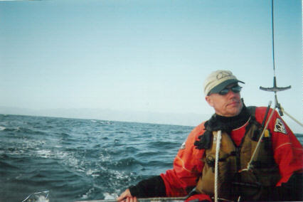
We discussed our options. Trying another weekend. Spending the night at the harbor and making another shot the next morning, shifting the whole schedule one day. Or just going for it now. We decided to make a shot at it, turning back if things got dicey. Things now got even more challenging as we were getting headed with winds out of the South. We had specifically picked Santa Barbara as our departure point to get a beam reach point of sail all the way to the Island. Now, the wind was |
|
| coming directly from our destination and we were forced to tack to the West. Figuring we would most likely find wind to the West, we planned to continue that heading until we reached a lay line to Pelican. At that point, we would turn toward our destination, check the time, and make a call to go or no go. |
|
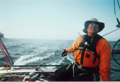
Our crossing was a total of 26 miles. By the time we make our tack towards Pelican, it was just after 2 pm. We had effectively made just 4 miles in 5 hours, and we had 22 to go. Now, it was a matter of doing the math to see if we could get there by nightfall. And the math was not looking good. We decided that we would give it another hour, and at 3 pm we would make our decision.
We sailed out of the coastal sun and under the Channel marine layer that is typical for this time of year. |
|
|
|
For this trip, we had added some new electronics to the inventory of gear, a Spot Satellite Messenger that would be texting the cell phone of my wife Leti, and sending her an email with a link to a map showing our exact position every time we pressed an OK button on the device.
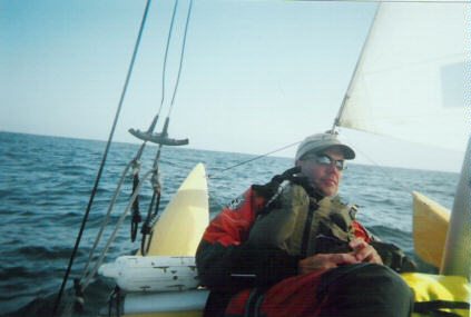
Also, friends were watching our reported positions on a webpage. Those watching us right now were probably wondering why the trip was taking us so long. We will see 10 kts. of boat speed by 3 pm, Thomas said. |
|
|
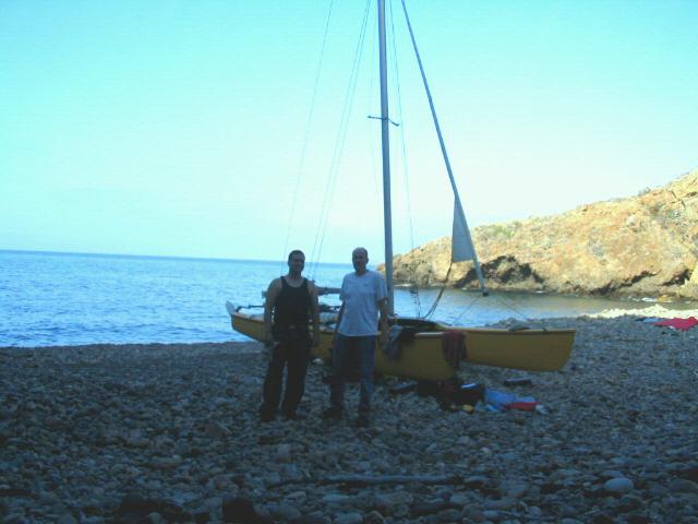
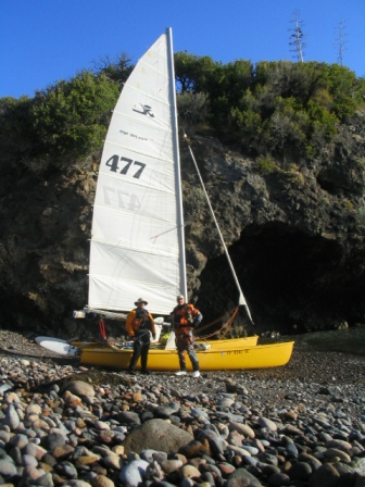
Yeah, right, I thought. Sure we will. By 2:30 we got our first good promising wind. Interestingly, we found ourselves in glassy water with decent wind. Absolutely smooth, reflecting water, with the bows cutting neatly into it like knifes through warm butter. From a sailors perspective, it was surreal, especially in this area. In a few minutes, the wind clocked around to the northwest. We were now on that beam reach we had originally expected, and the boat speed picked up dramatically. By coincidence I looked at my watch at exactly 3 pm, then looked at my GPS and saw our speed at 10 kts. Thomas had nailed it. A bit later, we saw dolphins ahead of us jumping clear out of the water. As we neared them, they predictably swam over to us and began to follow us. They did not stay long, but even when short lived, a visit by dolphin is always exciting to experience. As we neared the shipping lanes, we enjoyed a good 5 or 6 miles of visibility and saw no ships. Around 3:45 we felt the unmistakable influence of Windy Lane, 6 miles from the island. With Thomas at the helm, our boat speed moved into the teens, peaking at 16 knots on a broad reach. Soon we could pick out the details of the island, and as we neared it, we found ourselves in sunshine. I was able to put together the features of the land, and pick out the peninsula that would separate our landing site, Tinkers Cove, from the larger Pelican Bay. Thomas observed that the peninsula looked somewhat like a dogs head. We saw boats in Pelican Bay as we approached, and some of the people on board were probably wondering what such a tiny boat was doing this far out at sea. We switched positions with me taking the helm, and Thomas preparing the boat for landing. He untied the rollers, and removed the skids from the deck ports. We furled our jib as we entered the cove, and Thomas jumped off the boat as we hit the rocky beach. After setting the skids, we got the boat up over the first step of the rocky beach and out of the water. We consulted our tide chart, used a string level as a tide ruler, and determined we had to get the boat over one more step to be safe from the rising tide. |
|
|
We shook hands, hugged, and congratulated ourselves on a successful crossing. We deserve this!, I exclaimed. After overcoming all the problems of the morning, we persevered and ultimately earned a great end to the day. We enjoyed some beer, and took in the view of what would be our home for the next couple of days. |
|
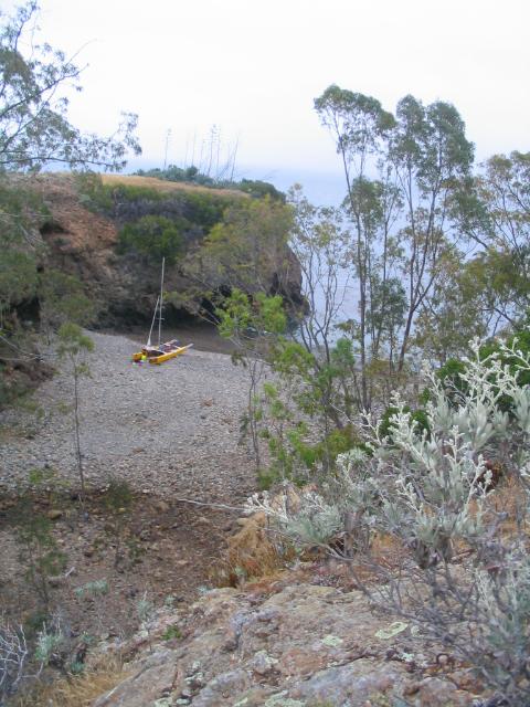
The larger Pelican Bay that provided shelter to larger boats was next door, out of sight behind a tall land mass. Our smaller cove, called Tinkers Cove, provided no such shelter for larger boats. This cove was all ours. And in the afternoon sun, it was a beautiful place.
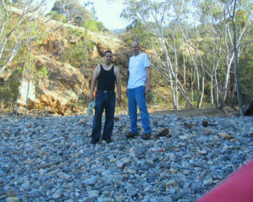
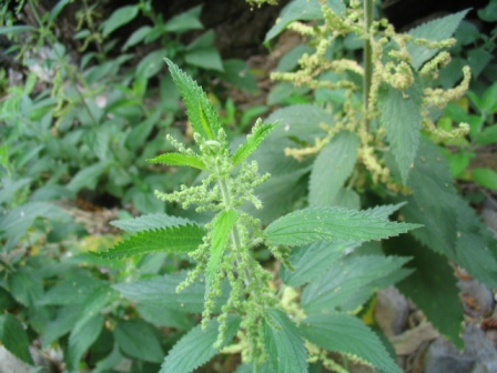
Having been here before, I showed my son all the nearby sights. The ruins of the resort run by Margaret and Ira Eaton in the early 1900s, and the spring at the end of the canyon. I had my first encounter with Stinging Nettles near the spring, just brushing my forearm against a plant. This effected a two inch patch of skin near my wrist, giving me a mildly annoying burning sensation for the next 2 days. |
|
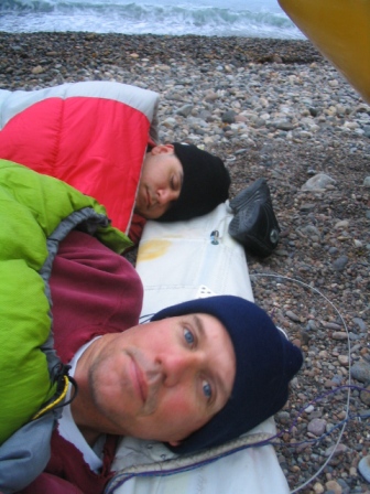
After some exploring we returned to the boat and had dinner and some Margaritas. At 9 pm, with some light still in the sky, we found the trials of the day had us both ready for bed. We cleared large rocks down to a small sized gravel, spread our bags down on it, and hit the sack. I looked up at the stars that were just starting to become visible, listened to the gentle surf echoing off the cliff in front of me, and took in the solitude that only this island can offer. After a very long and trying day, we both quickly went to sleep. The first time I woke during the night, I looked up to see a dazzling array of stars. So many of them, that the dark part of the sky seemed dithered with small white specks, almost as if the sky was made up more of the points of light than the dark background. |
|
The next day, I woke at 5:30 and could not go back to sleep. I rose at 6 am, had some coffee, and took a walk on the beach. The wind was already up. Usually, there is no sailable wind until about 10 am or so. Today, there were visible whitecaps in the channel at 6 in the morning. Taking note of this, I was already planning for an earlier than normal departure for the next day.
Once Thomas was up, we had some breakfast bars, changed clothes, packed some food for lunch, and otherwise prepared ourselves for a hike up the canyon. Thomas pressed the OK button on the Spot Messenger to hopefully send a message back to my wife to let her know we were okay. We had been sending her this message occasionally throughout our stay. This being our first experience with the device, we were not completely sure that it was working. (We found out later, it was working fine.) |
|
|
One downside to these adventures is knowing you have loved ones at home that are worried about you. And we were well out of cell phone range, so a phone call was out of the question. That is what made the next chance encounter both coincidental and valuable.
|
|
I teach basic sailing at the Santa Barbara Sailing Center. And while we were preparing for our hike, I noticed a Catalina 42 sailing by, less than 100 yards from the beach. It had the Santa Barbara Sailing Center logo on the stern, and I immediately recognized the boat as Califia, and the man attending to items on the forward deck as Captain Rob Bollay, a sailing instructor most likely teaching a course at the time.
HEY ROB!, I yelled. He looked up, then waved to me. I waved my handheld radio in the air and hailed him on Channel 16. After switching channels, I told him that I needed a favor. If you are returning today, could you give my wife a call and let me know we are okay?, I asked. |
|
Sure. No problem, he replied. Give me a minute to get a pencil. After giving him the number, I was relieved to know that those on shore would eventually know we are okay. I found out later that when Rob had called my wife, he recounted what had happened. I hear this guy yelling to be from shore, see a beach catamaran, and thought that it must be Bill. Who else could it be?" |
| Our bags packed, we departed the boat for our hike. My last visit to Pelican Bay included a visit to the spring and just a peek at the creek bed and canyon above it. This time, I was determined to hike and explore that canyon. My first objective was to stop at the Stinging Nettles I touched yesterday and get some pictures, now that I knew what the plant was. I wanted to become very familiar with the appearance of that plant. |
|
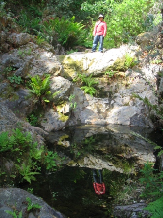
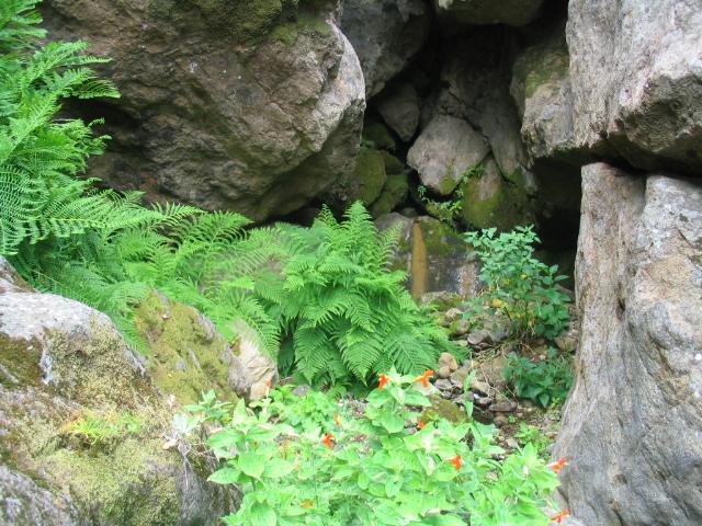
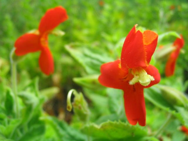
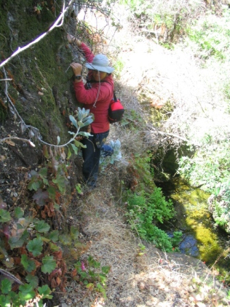
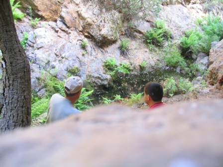
| After pictures of the plant, we climbed the steep rocky hillside next to the spring. Once on top, we followed the creek bed up the canyon admiring the ferns, flowers, and rock formations. Once far enough away from the beach, the sound of the surf was replaced with a calming quiet that was broken only by the sound of the birds. The noise made by the occasional visit from a hummingbird was stunning when it broke the silence. |
|
|
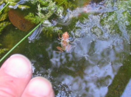
We came upon small pools of water, and every one of them had life in it. Most notable were tadpoles and dragonfly larvae. Thomas keen eyes picked out a frog that was no larger than a fingernail.
My 50 year old eyes were picking out other things. Hey! There is a lobster in this pond!, I yelled. Oh, yeah. Wow. A lobster,, Tom said, while filming in a different direction with the video camera. |
|
|
Then I realized it was the leaf of a fern at the bottom of the pond that looked like the pattern of a lobster tail. Never mind. It was a fern, I said. I dont think he ever stopped filming in the opposite direction. At one point during our hike, we had to traverse a very narrow dirt ledge over a 10 ft drop to some rocks. I had to grab some handholds on the rock wall in case the ledge gave way under my feet. Thomas filmed my successful crossing, then it was his turn. If you see more video, then I made it. he said to the video audience. If you dont, then tell the doctor which foot goes onto which leg. He made it. |
|
We found a great spot for lunch, on a rocky outcropping in the shade over a small pond. Cheese, crackers, and sardines made a great snack. Ice cold water was the drink of choice, a result of the hard work of hiking and climbing.
Our 2nd hike of the day was a search for Bald Eagle nest somewhere above the bay. Although it is currently empty, , and each year you can watch a nesting pair nurse its young. |
|
|
Last year, from the deck of a Catalina 50, I had seen a microwave dish that transmitted the signal from this webcam. Unfortunately, after hours and hours of hiking and searching the hillsides, we never found the nest.
|
|
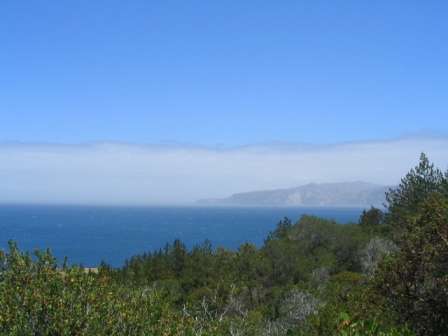
Still, we enjoyed good views from our elevation of nearly 400 ft. The channel was solid whitecaps, as it had been the entire day.
Returning to the boat, we took a break and had a couple of beers, and had our 2nd remarkable coincidence of the day. A couple walked up to our boat for a look. I approached them, and recognized the man as Mike Pyzel, local Santa Barbara mariner, sailing instructor, and boat surveyor. |
|
Last year, I had attended a couple of the seminars he holds at the Santa Barbara Maritime Museum. Back then, I had told him of my voyages to the islands on a beach catamaran, and I am not sure if he remembered me. Actually seeing the boat on the island will probably make me more memorable.
He and his friend Valerie had sailed to the island the night before on his Cal 28 Caballo Blanco. I saw a mast on the other side of the hill. It just didnt look right so we had to come take a look, he said. Mike appeared fascinated with the boat, the modifications I had made for island trips, and with our skill in making the crossing. Considering his reputation as a knowledgeable sailor, it was a high compliment to have his appreciation for our accomplishment. I told them of the spring at the end of the canyon and they soon departed to hike to it. |
|
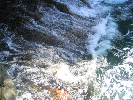
Later, Thomas and I walked over the hillside to Pelican Bay to walk on the reef at low tide. Around the corner we saw Mikes dingy, and a bit further admired a small sea cave with a surge roaring up into it, then cascading down the rocks in waterfalls. Starfish pepped the rocks below the surface, and a bright orange Garibaldi could be seen swimming nearby. We were still there when Mike and Valerie returned to the dingy. Would you like to join us for dinner?, Mike asked. |
|
|
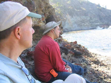
I immediately thought of the dinner Thomas had brought. Fresh cheese ravioli with alfredo sauce. I had been looking forward to that dinner most of the day, thinking of how warm and wonderful that would taste on the beach that evening. However, how could one turn down such an invitation? I looked to Tom. Sounds good to me, he said. That was all I needed. We graciously accept!, I replied. Mike advised that we get some flashlights for the walk back after dinner. Besides that, we were looking at potentially heavy weather the next day and wanted to get some things prepared that evening so we could leave early the next day. We said we would be back within an hour or so, so Mike was going to watch for us from his boat and paddle in to pick us up in the dingy. We got back to the boat, and prepared our rollers and skids for turning it around, bows to the water. Most of my sailing to the islands have been done on Gary Friesens Mystere 6.0, a larger boat with greater carrying capacity. Where the Hobie 18 shines in comparison is the maneuverability on shore. The hulls have a slight rocker shape, and the boat is lighter. We grouped a combination of rollers and skids at the keel of one hull, and reserved two to set the other hull down onto. We then lifted one hull, and spun the boat around about one third of a turn. Repeating this two more times, the boat was positioned for departure and we had never touched a hull to the rocky beach. We walked back to the reef, and waited, watching Mikes boat. Within minutes, he was paddling his small inflatable dingy to us. |
|
I can only take one at a time, he said. I went first.
I know how hard these little boats are to row, and I told Mike I would be happy to take turns with him. As a testament to what great shape he was in, he paddled the entire distance to his boat without a break. At about 15 years under his age, I would not have been able to accomplish the same. Still, I agreed that I would be the one to paddle back and get Thomas. |
|
As we neared our boat, a boy approached us in an outboard equipped rigid hull inflatable, from one of the nearby anchored motor yachts. Need any help?, he asked. You could go pick him up, I said, pointing to me son. He quickly departed towards the shore. I think we just sent a nine year old to a rock reef with a boat to get your son, Mike joked. The boy demonstrated his skill in picking my son up and getting him back before we had boarded Mikes boat. Once we were both on board Caballo Blanco, Valerie poured us some wine and we enjoyed appetizers in the way of garlic sautéed mushrooms, and an assortment of cheeses, while pasta cooked on the stove. Any regret Thomas and I had of skipping our planned dinner on the beach vanished as we thoroughly enjoyed the food, drink, and fellowship with these two capable and skilled sailors. It was a chance encounter that blossomed into a very delightful evening. Having more departure preparations to make, we had to leave before darkness. With the return trip being with the wind and waves, Mike said all three of us would fit in the dingy at the same time. He skillfully maneuvered the small craft sideways to present more surface area to the wind and waves, letting the forces of nature take us ashore. We bid Mike farewell, and quickly ascended the hill to get pictures of Mike returning to his boat. 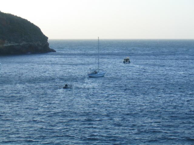
The wind was still blowing hard. A check of the NOAA weather forecast revealed Gale Warnings in the areas just to the north and to the south of us, and Small Craft Advisories for the afternoon in the area we would be in. Thomas suggested that before going to bed we get everything ready to go for departure, including sleeping in the clothes we would be wearing under our dry suits the next day. So everything was packed, with the exceptions of our sleeping gear and coffee and breakfast bars for the next morning. Then he broke out his treat for the weekend, a small container of Absinthe liquor. The fragrance and warmth it brought was welcoming in the cool wind of the evening. With the wind blowing hard, I slept very little this night. We were sheltered out of the wind between the boat and a cliff. However, I had a view of the canyon trees in the starlight, and they were bowing far down in the wind. We are not going anywhere tomorrow, I thought. It blew the entire night. Our float plan given to my wife specifically stated that if we were not heard from by 6 pm the next day, the Coast Guard would be called with a report of an overdue boat. Now, my mind was racing as to how we would extend the float plan for 24 hrs. I could try calling Mike Pyzel on the radio the next day and have him call my wife. That assumed both that he would still be there in the morning, and that he would be returning. The other option was to hike to the ranger station at the east end of the island near Scorpion Anchorage, an estimated 9 to 10 miles away over somewhat rugged terrain. Or attempt to sail down there in gale winds. I laid awake, contemplating these options, when the wind came to an abrupt stop at 4 am. I was up around 6, enjoying some coffee. While there was not much wind, there was definitely enough to sail in, and it was already coming from the Northwest. Thomas was soon up having his coffee as well, and we both observed some whitecaps in the channel by 7 am. 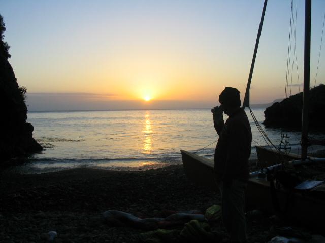
|
|
Our preparations the night before now paid off, as we were off the beach at 7:45 am, a departure time at least 2 hours earlier than any previous trip I had made. We had to paddle out of the cove, but with a very distinct wind line ahead, we had stowed the paddles while still in a calm area of water. I saw some spectators on boats in Pelican Bay, with at least one of them observing us with binoculars.
We hit the wind line 5 minutes into our crossing and were soon making 14 kts. to weather, on a close reach in the moderately rough seas that had been hacked up the night before. A check of the GPS had Thomas bust out laughing. It says our ETA at the harbor is 9:45 am, he said. |
|
Our on-deck equipment and snack bag was now on the leeward side of the boat, and I thought about my cell phone in a double zip lock bag in one of the outside pockets. That bag was being pummeled with salt water that looked to be hitting it with the force of a fire hose, and ricocheting up into the sails.
We knew that 9:45 am ETA would probably not hold up, once we were out of Windy Lane. Sure enough, an hour into our crossing, our boat speed was cut in half in the reduced winds. It was an uneventful crossing, free of wildlife, freighters, and equipment problems. As we neared the coast of Santa Barbara, we had our THIRD encounter with someone we knew. My friend Steve, a fellow instructor at the Sailing Center, was teaching students on a J-24. He recognized my boat, saw all the gear on board, and told his students, Those two are coming back from Santa Cruz Island. We approached each other, traded greetings, and I let him get back to his class. We entered the harbor and tied up to the dock at 11:32, making the crossing, beach to dock, in just under 4 hrs. On the dock, we gave each other a hug for a job well done. It was one of the best island trips I have ever had. We both had the tenacity to overcome our initial difficulties, and were rewarded with great crossings, fantastic weather, magnificent scenery, and chance encounters with other sailors. It was a Fathers Day weekend I will remember for a long time! |