The Objective
Our main objective for this trip would be a visit to Christy Ranch, including a group of three or
more buildings near the west shore of Santa Cruz Island. Christy Ranch is an out ranch located
approximately 11 miles west from the Main Ranch, the later located in the islands Central Valley.
The origin of the name Christy is unknown. One possible explanation is that one of the islands
owners, Jusitnian Caire named it after his wife, Albina Christina, or possibly after their youngest
child, Marie Christian Caire. The first known reference to the name Christy Ranch appeared on
the payroll records of December 1891. (Santa Cruz Island: A History of Conflict and Diversity,
John Gherni, 1997). Prior to this time, the facility was referred to as The West Ranch. The
centerpiece of the ranch is a two-story adobe constructed in the early 1860s.
The closest landing to Christy Ranch is Christy Beach on the west side of the island. In planning
for this journey, it was obvious that it would present far more challenges and hazards than those
presented in previous trips. Christy Beach is fully exposed to both the prevailing northwest wind
and swell. It is outside the lee of both Point Conception and Santa Rosa Island. If you were to
extend a line northwest from Christy Beach, it would not hit land before the Aleutian Islands.
|
|
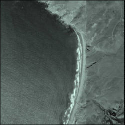
Our research of this beach included references to nautical charts, topographical maps, aerial
photos, historical accounts, and the personal accounts of other mariners with good local
knowledge. The culmination of research revealed the exposed location to be, at most times, a
windswept beach pounded by heavy surf. However, aerial photos suggested two possible landing
sites as alternatives to the main beach: 1.) A small beach to the south, at the entrance to Canada de
la Sauces, and 2.) The northernmost portion of Christy beach where the surf appeared to be smaller.
|
A more conservative alternative was a landing at Pozo Beach on the islands south shore, which
would require a days hike to the ranch. This hike would take us up and down over at least four
mountain ridges, and would leave the boat deserted at Pozo beach for two days.
Another option was to sail past Christy, landing at Forneys Cove to the north. This would require
a four-mile hike to the ranch, but over more level terrain, relative to a hike from Pozo. Forneys
presented its own set of challenges. Although protected from swells by a large reef, there is very
little shelter from downdraft winds. Moreover, the infamous Potato Patch lies a short distance
west of the anchorage.
The infamous Potato Patch is a highly treacherous and formidable area that is the net result of
many physical forces, all colliding in one spot. The unobstructed winds from the northwest carry
their own wrath and produce wind waves that combine with the seas, which are usually coming
from the same direction. They enter the Santa Cruz Channel between Santa Cruz and Santa
Rosa Islands where they are funneled and accelerated, developing a stronger force. At the same
spot, there is an upwelling of the sub-surface water currents that are in opposition to the seas.
These currents from the South are accelerated and funneled by a radical shallowing of the
continental shelf where the depth suddenly decreases from a wide canyon that is about a mile
deep; to a narrow passage that is only some eighty feet deep. The result can produce standing
waves that grow to become much larger than the surrounding seas.
Preparation
Equipment failures had been a problem on previous trips. Aside from punching holes in the hulls
on landing, we had broken the rudder system numerous times. Rudder castings were broken on
four occasions during landings (as waves struck the sterns), and we completely shattered a
rudder blade in heavy following seas on a trip to the north shore last year. On one occasion we
sailed home across the channel on one rudder. Another time, we sailed on a rudder blade that
was patched back together with a piece of tin. Our trip to Christy carried the potential for the
roughest seas, wind, and surf of any trip taken so far. Moreover, this trip would take us farther
from the mainland than we had ever been.
For this season, Gary had made some major modifications to the stock Mystere Rudder system.
The castings were reinforced with one-quarter inch aluminum plate, and rubber stops were
installed to cushion the blow of the castings behind thrown to their limits during surf landings. He
also designed and fabricated a latch to hold the rudders higher up (past horizontal) to keep the
rudders out of the surf as we hoisted the boat onto the beach.
We had decided that the single worst catastrophic failure on this trip would be a dismasting in
heavy seas. For this reason, it was decided the boat would be double shrouded for this trip. Also,
a reinforcement line was added to the forestay.
|
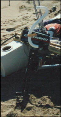
Another refinement was a larger motor. We would have a 3 hp outboard to assist us when
becalmed, and when moving in and out of sheltered coves. Gary had designed a snorkel for the
motor, to keep it running when momentarily submerged by swells or waves.
As during previous trips, we would also be equipped with our rip cord system to instantly jettison
our cargo bags in the event of a capsize, and the roller/hoist system to get the boat above the tide
line on landings.
Waterproof Adventure Paper allowed us to carry a nice book of references that we usually
compile for each trip. Having always to keep them in a waterproof bag has kept us from paging
through our references. But this time we would be able to pull out any page we want to view,
without the chance of loosing the information if it got wet. We had our usual assortment of charts,
satellite images, lists of waypoints and compass headings, tide chart, moon and sun charts, and
photographs of destinations.
| 
|
Due to the length of the trip, drinking water was going to be more of an issue. We would be
bringing 12 liters each, which would add a considerable amount of weight to our cargo bags. I
also carried an extra container of butane/propane fuel, in case we needed to use our stove to boil
water.
Ventura Harbor is nearly 90 minutes away for each of us. This distance would require us to get up
at 4:00am in order to get to the harbor, rig the boat, and get on the water by our scheduled
8:00am departure. Considering the grueling nature of these trips, it never seemed reasonable to
start them off with only a partial nights sleep and a long drive to the harbor.
For this trip, I borrowed a Ford E150 cargo van. This would provide sleeping quarters at the
harbor. It would also allow us to get the boat together the evening before.
During the rigging process, we spent considerable time examining a reefing cleat installed in the
mast track near the base of the mast. With the mainsail in the reefed position, the main halyard
would be secured to this cleat. Gary was concerned that the cleat would slip, causing the main
halyard to become unsecured. After considering what few options we had available to remedy the
problem, we decided our only option was to trust the cleat.
My wife, Leti, joined us for dinner at the harbor, where we barbequed some steaks, and enjoyed an
excellent California wine that Gary had supplied.
Day One
We arose at 5:30am to the sound of fisherman at the boat ramp. The Mystere was mostly rigged
the evening before, so we just had to finish the job and load up our gear. The extended trips gear
and supplies had our cargo bags over 60 lbs each. I made a coffee run to the local Starbucks for
that last cup of fresh coffee and a fresh cinnamon roll.
|

|
We shoved off at 8:00am, and had surprisingly good winds under a marine layer. We departed
the harbor without ever starting the motor. The crossing went very smooth, and we soon
encountered some dolphin along the way.
At approximately 9:30, I noted a freighter to the west on a course, which would traverse our own.
|
We also had a freighter to the east, which would be passing well behind us. I took a bearing on
the freighter to the west, and decided to re-check it every few minutes. Within 10 minutes or so, it
was apparent that the ship would pass well in front of us. In the meantime, a second freighter had
appeared behind it, and this one was obviously going to be a close call.
By 10:15, the bearing had not changed, and it appeared we were on a collision course. At 10:20, I
told Gary this was going to be too close.
Should I tack? asked Gary.
Yes, I replied. Lets tack.
Prepare to tack. Gary responded, before I had finished my reply.
Just as Gary started to swing the helm, we heard the low-pitched horn of the freighter. The guy
sounding the horn must have felt like he was sailing a remote controlled catamaran. He pushed a
button, and the Mystere immediately tacked.
We were only on the new tack for about 5 minutes to allow the freighter to pass without nicking
the leading edges of its propeller blades on our mast and trampoline frame. We are both pretty
kind hearted in that way. As we crossed the freighters wake, we saw tons of kelp that had been
pulverized by the freighters prop blades and felt glad to not be a part of the sea-stew.
|
We continued on, staying on the east side of the Anacapa Passage in an attempt to avoid the lee
of Santa Cruz Island. Soon we found ourselves in the lee anyway, and had to start up the motor
at 11:00am. After an hour of motoring, we had moved far enough south of the island to find wind,
and we were back under sail.
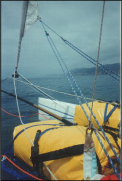
By 1:00 p.m. we had good wind that was gradually building along with the seas. Soon we were
double trapped and beating against the seas much like our journey through this area a year ago.
We were on schedule to reach Pozo before sundown. The evening winds, locally known as
sundowners would undoubtedly give us a wild ride as we neared our destination that evening.
|
|
As we reached a point as far West as Willows Canyon, the wind began to build, just as it did the
last time we visited this, one of our most favorite anchorages. In our experience, once we reach
as far west as Willows, be begin to feel the influence of the wind that funnels through The Santa
Cruz Channel between Santa Cruz Island, and Santa Rosa Island to the West.
Wind usually builds up to higher forces at the Channel Islands, and we were beginning to feel the
effects. We had enough wind to give us the incentive to douse the headsail, using the roller
furler. We also began to encounter larger, steeper waves. As it breezed up we took the
necessary steps to trim the boat accordingly; douse the jib, flatten the main by bending the mast
with the use of the main sheet and the downhaul that work in concert with the diamond wires and
aft-swept diamond wire spreaders, let out the mainsheet traveler, both men on the trapezes, and
redistribute our fore-aft body placement to accommodate the larger waves.
As we worked through the necessary changes in boat and body trim, we began to talk our way
through our options as we always do as a matter of safety. When circumstances change, we try
to readdress our given situation from a new and current point of view. We discussed the
possibility of the weather continuing to increase, to a dangerous point. Listing various options,
landing at Willows was becoming a very likely possibility to avoid some very harsh sailing
conditions between here and Pozo.
We agreed to make for Pozo, in case we would need to land, and then take another look at our
situation at that time. So we turned slightly further away from the wind and sailed a Beam Reach
for the beach there. As we came nearer to the Island, our wind began to diminish. We were now
underpowered and chose not to re-deploy the jib so that we could take an adrenaline break, catch
our breath.
Cruising at 8 knots, with both of us on the wire and the windward hull skimming the waters
surface, we were suddenly pitched forward into a bow diving condition. The tops of the decks
were plowing water and our speed dropped immediately to 4 knots. Luckily we were not thrown
forward from the boat. Geeez! What was that? Gary shouted as he turned his head and looked
backward. No large objects, no kelp was visible and I let Gary know that it must have been a
Sunfish, also known as a mola mola fish. I had just spotted a few of them, right before we did
the abrupt slow-down.
It was strange to have the boat act as if it was being tilted forward, when there was no gust or
wave. We were riding along with our sterns lifting from the water for a short while. Then we
settled back down and all was fine. Later we found that one of the centerboards was partially
pushed up and its hinge jumped the track. This must have been the part of the boat that hit the
obstacle.
When that was over with, we congratulated each other on being able to keep the boat upright and
on not being thrown overboard. We were very glad that we had chosen to sail in an
underpowered mode for this short leg of the trip.
We came close to Willows and decided that we could beat upwind toward Pozo, remaining close
to the island. If we became too exhausted, had equipment problems, or the seas became unsafe,
we would turn downwind and "run" to Willows for shelter. We could run with no sails if necessary
and still be able to get to a sheltered beach.
It was time to further reduce our sail area exposure so we dropped the Main down to the custom
reef point. Gary has worked out a very good reefing system and is still ironing out a few minor
details, such as where is the best place to anchor the halyard cleat.
At 2:15, south of Willows Anchorage, we found ourselves in very steep seas on the bows with
enough wind to overpower us while sailing under reefed mainsail only. We were double trapped,
with a reefed main and furled jib. I started thinking about what the west end of the island would
look like if the south side looked like this
It was time to get some more flattening into the reefed sail. Gary yelled for more downhaul, and I
complied. Then, I complied a bit more, maybe too much. We heard a loud SNAP, and the main
went slack. We both swung in. The response was so automatic and quick, that Gary thought that
the rig was falling because not only was the sail slack, but he was watching me as I appeared to
fall toward the deck. I must say that I also wondered if he was coming in from the trap or actually
falling off the boat. It was quickly evident that the reefing cleat was gone. The cleat that we had
doubts about the night before had indeed failed on us.
I grabbed the tiller and tried to keep the boat pointed to weather while Gary went to work on the
boat. First he detached the mainsail clew from the boom, and then went to work getting the sail
back into the reefed position, rigging the halyard with a stop knot. Now he had to get the boom
back on the mainsail in rough seas, which was no easy task. Without the main, I had very little
steerage. So Gary had to manually pull the foot of the main in to get me steerage and get the
boat to weathervane. As he struggled to get the clew attached, the bows would quickly fall off,
moving the clew of the main back off the deck to windward.
After struggling with this for a while, Gary asked me to try and run downwind in an effort to keep
the main over the deck. This maneuver quickly ripped the main from Garys grasp, sending it
around the shrouds, snapping an upper batten. We jibed to bring us onto a course toward the
Island that was also a course less hammered by seas. Gary now rigged a line between the
mainsail and boom, using two-part purchase, to bring the two together. I admired his dexterity at
pulling this off. He was balancing and leaning out over the leeward deck, and I thought for sure he
was going to go swimming. Every once in a while, I had to warn him about a big wave so he could
stop and just hang on as it passed. Each time, he would take a couple of steps forward, hang
onto the shroud, then return to his work station at the clew of the mainsail. The line trick worked,
and Gary soon had the clew properly secured to the boom.
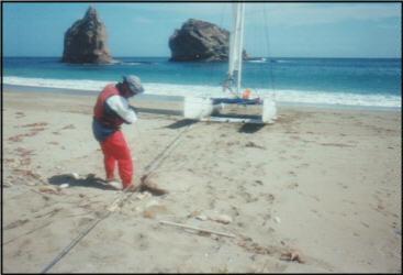
With the boats rigging partially compromised, we decided to play it safe and head back to
Willows Anchorage. We found the bay deserted, with a lone fishing boat at Alberts, the
anchorage next door. We landed the boat at Willows at 3:25pm.
|
|
We broke out the anchor block system and the rollers, and hauled the boat up above the tide line.
Correctly spaced, the roller system works really nice! After getting the boat high enough on the
beach, Gary noted his starboard centerboard gasket had come off the hull. Resourcefully, he
used this as splinting material to repair the batten.
|
After changing to land mode we took a hike up Willows Canyon. About one-half mile up the
canyon we found fresh water. Walking further took us into scenic areas along a running stream
with waterfalls. After hiking about one mile, we returned to the beach.
At least one of us has a surprise for the other on each of these trips. It was my turn. At the start
of the trip, I had told Gary he was not allowed to go into the on-deck lunchbox. If he needed
anything out of it, he had to ask me to get it for him. Now I went to the lunchbox to get to work.
|

|
Gary was working on making our sleeping area with his trusty rake. He had designed a small rake
head that would fit on the end of his tiller stick. This allowed a quick way to grade a level sleeping
area free of rocks and debris. One of the issues at this site was the wind. We had spent a good
deal of time trying to scout a place to sleep that had some shielding from the wind. Gary found a
nice spot behind some willow plants and was working away at making it hospitable.
Are you ready for an appetizer? I asked.
Sure. Gary replied.
After finishing my surprise from ingredients in the lunchbox, I came back with fresh shrimp
cocktails, complete with fresh lemon wedges. Gary was really floored by it. I was just glad the ice
had lasted just long enough to avoid me getting us both sick. When I originally put the idea
together I figured it was either going to be really cool or possibly kill us.
In this regard, it reflected the spirit of this particular trip rather well.
After the cocktails, we fired up the stove and cooked up some dinner, and talked the night away. I
think it is a true test of friendship to be able to keep each other company for hours without any
other distractions, such as television or radio. Alternatively, maybe time just passes if you both
talk too much. Either way, the time spent with Gary on these lone beaches always passes
quickly. Shortly after dark, we hit our sleeping bags and called it a day. Without a moon on the
rise, the stars were very bright.
Day Two
The wind may have been a bit annoying over night, but it was appreciated in the morning. For
once, our sleeping bags were not covered with dew when we awoke. It is not uncommon to
awake with the outside of the sleeping bag soaked with dew.
On this morning, it was bit chilly. The stove, coffee, and food were all within easy reach. So I
made my coffee and breakfast without getting out the sleeping bag. Breakfast in bed at Willows
Anchorage!
After breakfast, we broke camp and started getting ready for departure. Our next scheduled stop
was Christy Beach on the West End. We both saw this landing as the riskiest part of the trip. The
beach faces northwest, directly into the prevailing wind and swell. I was hoping to get into this
area early in the morning. But since we had cut our trip short the day before, we were 4 miles
further from Christy that we should have been. By the time we left the beach, it was already 9
am. We probably would not be getting to Christy until noon, I thought, and by then, things
would be hopping. Oh well
I guess we will deal with whatever we get.
|
|
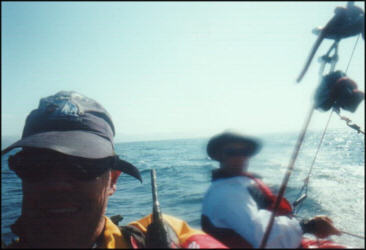
As we moved west, the seas changed abruptly, and it was clear that we were no longer in the lee
of Santa Cruz Island. These swells were coming straight down the Santa Cruz Channel between
the two islands. Not long after, the seas settled down as we moved into the Lee of Santa Rosa
Island. The wind kept up, though, so we had great sailing on smooth seas.
|
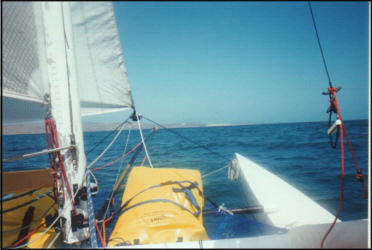
We crossed the Santa Cruz Channel, as our point of sail took us towards Skunk Point on Santa
Rosa. At this point, we considered just sailing to Bechers Bay on Santa Rosa since we were
practically there. Putting off Christy until the next day would allow us to land there earlier in the
day. We thought we might find calmer conditions in the morning, and it would certainly give us
more time to hike.
|
|
|
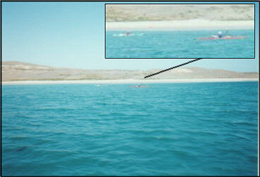
As we neared Skunk Point, we noted a couple of kayakers on the beach. As we got closer, they
moved into the water. After we made our tack, we waved and took pictures of them. I was yelling
and showing the camera, but I never got a wave from them. I put the camera away and we
continued on into the Santa Cruz Channel.
|
This is where another option presented itself.
|
|
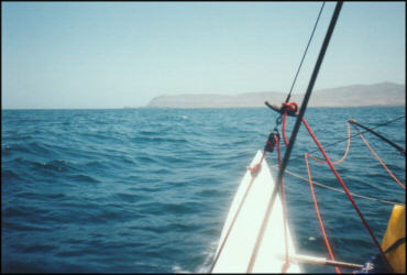
Our point of sail was now taking us towards Forneys Cove on the northwest tip of Santa Cruz
Island. This was an alternate landing spot to Christy. The idea was that instead of landing in
rough surf on Christy, we could land at Forneys, and then hike southeast to Christy. Just staying
the course now would take us right to Forneys. We decided to head towards it, making a slight
deviation to the south to avoid the infamous Potato Patch.
|
|
The so-called Potato Patch extends two miles west of West Point, a zone of turbulent water
caused by opposing currents in the Santa Cruz Channel and the main Channel. In heavy
weather, westerly swells are confused by these opposing currents, creating an extensive area of
dangerous and turbulent seas. Even on calm days, overfalls caused by the currents can cause
the sea to seeth and ripple. In any wind or swell at all, the Potato Patch comes alive with steep-
sided, chaotic seas, moving in all directions.
Crusing Guide to the Channel Islands, Fagan &
Pomeroy
My
What a lovely place.
We looked and looked as we approached Forneys, but never saw any chaotic seas. Then again,
it was a very calm day as far as seas were concerned. There were some fairly decent rollers
coming through in sets now and then. Those big, long smooth ones that usually dont bother me
at all. In this case, they bothered me a little. They were passing under the boat and marching
resolutely to the southeast, on a direct course to Christy Beach, the beach that we would attempt
to land on the next day.
Looking at the distance between Forneys and Christy, the hike did not look like any fun at all. It
made much more sense to attempt the landing at Christy Beach the next day. Sure, there was the
chance that strong surf would pummel the boat and us against rocks and cliffs, reducing Whisk to
bits and pieces, and leaving our partially decomposed, half-clad bodies to be found weeks later,
rolling around in the surge with our eyes pecked out by sea birds.
But, at least we would have avoided that annoyingly long hike.
We really wanted to check out Forneys. It has very calm water and provides hiking access to
Frasier Point, the island's spectacular Northwest peninsula. We had always supposed that we
would never get there since it was surrounded by such formidable sailing conditions. However, it
is in the lee of Frasier Point. As we neared the cove, we started looking for the kelp this area is
known for. Pretty soon we saw it everywhere. Noting the gaps here and there, Gary expertly
steered Whisk through the openings as if we were on a slalom course. We trimmed sails together
in concert with the needed course changes to manipulate the catamaran like a kid on a dingy.
We hit a clear sandy beach in what would be our smoothest landing of the day.
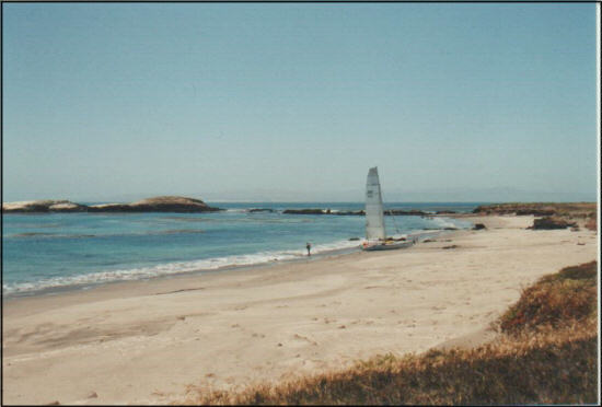
We had made Skunk Point to Forneys Cove in a single tack.
|
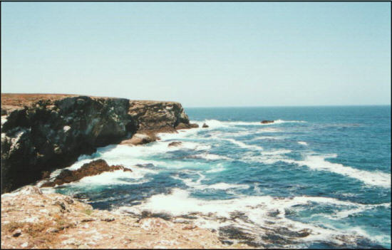
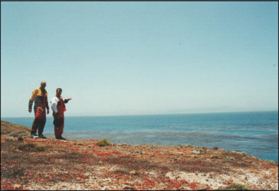
After securing the boat, we hiked in our spray suits to the end of Fraser Point. The views were
some of the most dramatic that we have seen on the island. This is the point that takes the full
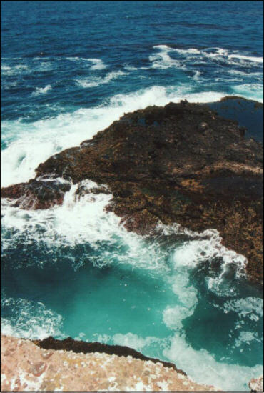
brunt of the prevailing swells. We stood at the end of a small cove and looked down 30 feet or so
to the churning water. On the ground among us were signs of serious erosion. It was clear that on
rough days, the swells would funnel into this cove, rocket into the air, then crash down to erode
the soil. Just then Gary put his arm out to me and moved us both back. We were both standing
on an outcropping, an eroded dirt overhang; all 370 pounds of us.
The landscape north of the point was simply awesome. There were rocks, reefs, gigantic tide
pools, sandy low tide only beaches, and the surge that rushed in all directions.
|
|
|

|
Muffled thunder
filled the air as huge waves bumped against the peninsula. I took several pictures, but knew I
would never capture such moments with photographs.
We noted a cross on the point, which was a memorial to diver Steve Crombie. While researching
this trip earlier, I had seen references to the cross on the Internet.
|
Although Steve did not die at
this location, it was one of his favorite dive spots.
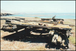
One the way back to the boat, I found some wreckage that appeared to be a barge or platform of
some sort. Extremely thick steel surfaces are corroding through. This device had been here a
very long time.
|
|
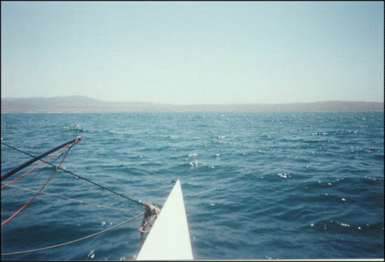
The launch from Forneys was equally as smooth as the landing. We maneuvered Whisk through
the kelp slalom course, then straight through the south portion of The Potato Patch. Although
some slightly larger waves were noted, the seas were very smooth. In fact, the water was
incredibly smooth for this area. We enjoyed about 10 or 12 knots of wind over water that
resembled that of a lake, making Bechers Bay in a single tack. That was our third crossing of the
Santa Cruz Channel in a half-day.
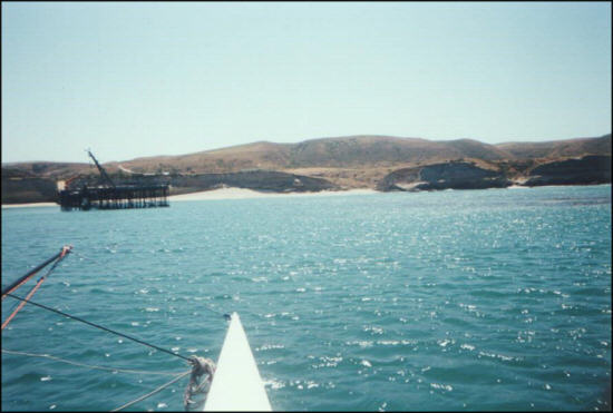
Upon sailing into Bechers Bay we both agreed that the conditions were probably some of the
finest we had ever been in for sailing. The water was smooth, the wind was decent, and the
scenery was breathtaking. Bechers Bay is enormous, and bounded by pure white sandy beaches.
We noted 4 large sand dunes clearly visible from a distance. We had been told by a couple of
sources to land close to the pier, so thats where we were headed. After scoping things out, we
decided the best place was to the right of the pier. There was a fair amount of kelp in that area,
but Gary steered us through with no problems.
We hit the beach like pros, throwing off our gear, getting the rollers and anchor in place, and then
hauling the boat up with the block and tackle. Once the boat was secured, a ranger
approached us.
I hope you have a campsite open, I said.
Ive got plenty open, said the ranger. But youre over a mile away from it.
Could we just spend the night here on the beach?
I dont suppose you guys have a beach camping permit.
No we dont. We intended to land, hike, and take off. But the time got away from us and now it
is a bit late to leave.
Well
I dont really mind, but Ill have to call this one in.
We are completely self contained. Food, water, wag-bags, everything, Gary said. Wag Bags
serve as small portable toilets for solid waste. Gary knew that just the mention of them was a
testament of our respect for the land. We are able to Leave No Trace, can sleep right on the
boat, and can come and go with no impact on the park.
Will you guys be gone by 11am? Thats when the enforcement officer gets here.
Well be gone first thing in the morning.
Well
then I personally dont care what you do. You guys can stay here. It makes no difference
to me. Just dont bother any of the ranch homes.
Thanks, said Gary. By the way, where do you get a cold beer on this island?
Well... The only place to get a cold beer on THIS island is from me, replied the Ranger, smiling and
thrusting a thumb to his chest. If I find you guys down here later, I just might have a couple of
beers with me.
We were looking around for a sheltered place to sleep and noted a small canyon opening onto
the beach. There was fresh water about 100 feet up the canyon.
Hey
This spot might work, I said.
Sometimes at night, the wind comes through here at 60 miles per hour, the ranger advised.
Swell. The Potato Patch of sleeping areas.
He went on to say that an east wind was expected. This gave us some concern, as it implied
there might be a Santa Ana Wind condition. Such an occurrence could send 50-knot gales into
the channel that would want to blow us out to sea. We decided to keep a close watch on the
weather and check the NOAA weather forecasts on our radios.
We asked the ranger about hiking and he gave us directions to the campground. He also advised us not
to bother the families who lived on the ranch who still worked on the island. Even though Vail and
Vickers (the ranch company) sold the island to the Park Service, they still maintain rights to
ranching operations until 2011.
The ranger also informed us that there were some Kayakers coming to the pier to tie their Kayaks down
since they would probably blow away in the wind. The guys had to be rescued, since they could
not make it back to their camp against the current. These would be the same people we saw
earlier. I guess this explains why we did not get a lot of happy waves for the camera earlier in the
day.
While collecting my gear off the boat, I noticed my VHF handheld radio was not on my PFD.
Apparently, the last time I secured it with the clip, I neglected to secure the backup lanyard in
case the clip detached. I looked all over the trampoline, but the radio was no where in sight. Then
I looked up and saw it dangling on a trapeze wire, where it had clipped itself. It was slowly
spinning around in the wind.
That was a warning, Gary said. You only get that chance once.
I promised myself I would never forget the lanyard again.
After securing our belongings away from the wind, we threw some food and water into the
backpack and started off on a hike.
We walked to the pier and found a ladder reaching down the beach.
As I climbed up the ladder, I remarked, The ranger was really nice. We should send him
something in appreciation. Like a bottle of Crown Royale or something.
A bottle of Crown Royale?!?!, Gary asked in amazement. The guy said I personally dont care.
Is that all it takes to earn a bottle of Crown Royale from you? Maybe when we were having all
those boat problems yesterday, I should have just stopped and said I personally dont care.
Would that get me a bottle of Crown Royale?
It took a while to calm him down. Man
Two bottles is going to set me back a bit.
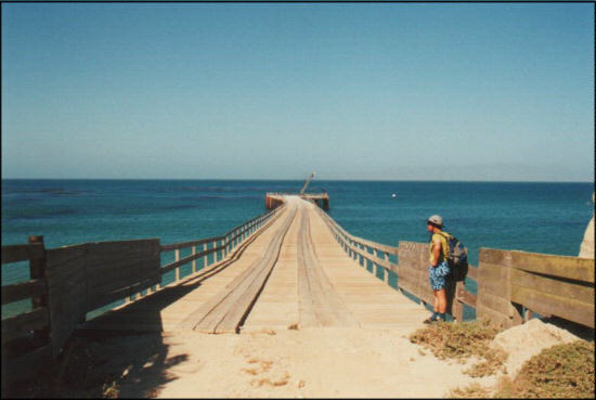
Once on the pier it was obvious that it was set up to herd cattle to it for loading onto boats. There
were corrals, cattle chutes, fencing, and holding pens nearby. We also saw what appeared to be
a cattle sling that would be used to harness a steer when hoisting cattle from pier to boat. As we
hiked up the pathway, we came to some barns and more fenced areas. Soon we were on a road,
walking towards some open pasture. On the right side of the road, there was a house, complete
with a picket fence, laundry on the line, and children playing in the yard. To the left of the road
was a breathtaking view of Bechers Bay, the Santa Cruz Channel, and Santa Cruz Island in the
distance.
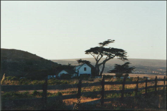
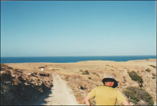
The modest home and the incredible view combined into a scene resembling something out of
The Twilight Zone.
It was difficult to walk down the road next to the unobstructed, expansive view of Bechers Bay. It
commanded one to stop and look. Walking on this plateau, there is so much
ocean surrounding you, with so little else around that you feel as if you are just floating above the
oceans surface. As we walked down the road, we came to a small grass airstrip, with a passenger van parked nearbly, obviously to accomodate visitors flying to the island.
|
After a mile or so, we came to a fork in the road and followed it to the right, towards the
campground. Behind us, a truck pickup truck drove by with a bunch of people in the back having
a good time.
They probably live here, the lucky bastards, I thought.
Once we got to the top of the hill, the campground came into view. It was still about a quarter mile
down the road, and consisted of picnic tables and giant windbreaks. Of all the places to put a
campground, they put it in a treeless, windy canyon. We walked down the hill towards the
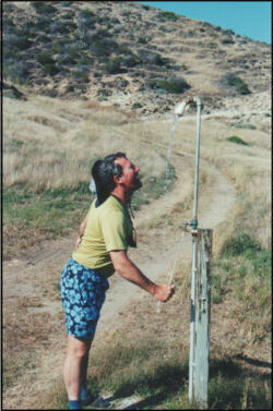
campground and found a small outdoor shower, along with some pit toilets. After a few trial runs,
Gary figured out how to use the shower:
|
|
1.Stand in front of the showerhead.
2.Pull the small rope attached to the valve.
3.Watch water dribble out and get blasted backwards, horizontally in the canyon wind.
After this refreshing sprinkle, we took a walk back up to the fork in the road, and then took the
opposite fork down to the beach. The road first led us down to the base of Water Canyon, where
we found fresh water and all the lush plants that come with it. The water ended in a very small
lagoon on the beach.
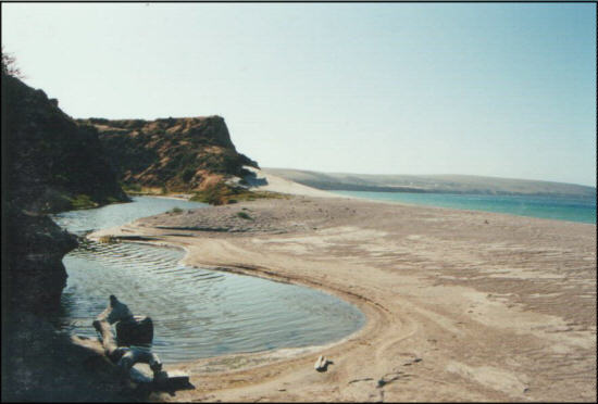
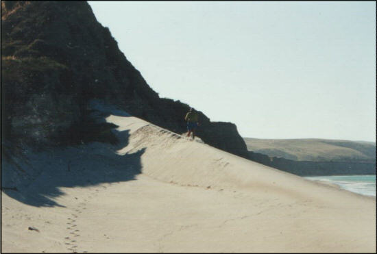
The beach was the same gorgeous one we saw on our way in. Pure sand and huge, perfectly
shaped sand dunes. I got a picture of an untouched sand dune both before and after Gary ran
down it. Although he scarred the sand dune scene, the high wind here would restore it in short
order.

|
Gary marked the entrance to the canyon on his GPS for future reference, as the place
looked like a perfect landing spot. We just were not too sure we would ever want to lug our gear
all the way to the sparse looking campground. Perhaps one sleeping bag and one towel per
person would not be too bad.
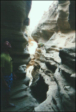
We had lunch on the beach at the base of the cliff face. Afterwards, I took a short walk and found
an interesting open ceiling cave leading into the cliff. At the end of the cave, there was actually a
decent place to sleep. A bit cramped for two people, but definitely sheltered, but well ventilated
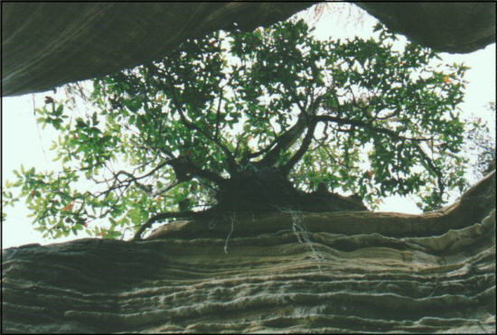
with the narrow open ceiling. About midway through the cave, we found a tree growing on one
side of the ceiling. You could actually look straight up and see the root system.
|
|
It was getting late, so we left the beach and walked back up Water Canyon.
|
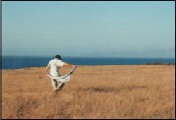
Once back on the road, I noted the giant field of wheat grass. I handed Gary and camera and told
him Id let him take a picture he could use against me someday. Then I ran into the field and did
an impersonation of Julie Andrews in The Sound of Music. I guess being on the open water for 3
days can really start messing with your head.
|
|
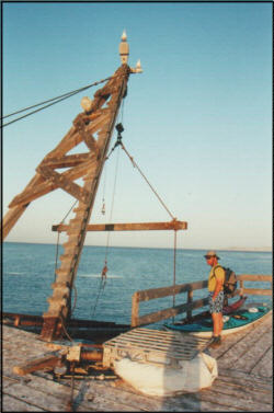
After getting back to the pier, we took a walk out onto it and saw the old crane used to load and
offload cattle onto the boats. Also there were the kayaks and a new crane. The sun was low, and
the whole bay was lit up in the golden light of the evening.
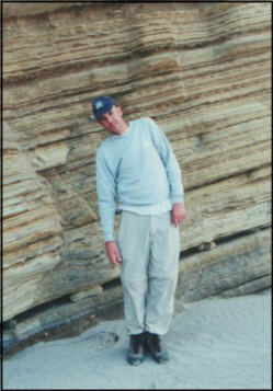
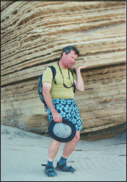
Walking back to the beach, we noted the unique angled strata of the cliffs along the beach.
These textured walls gave us a bit of an optical illusion and we were reminded of a Haunted
Shack at an amusement park that had crooked walls and floors that gave us the illusion that we
were standing up at weird angles.
|
|
|
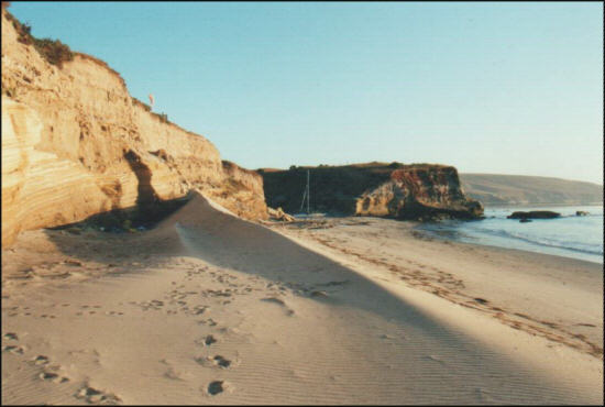
Once we returned to the boat, Gary found a nice sleeping spot out
of the wind. It was between a giant sand dune and a cliff. We retrieved our bags from the canyon
and brought them back to this spot. We laid our space blanket down at the end this sheltered
area, and configured our sleeping bags with our heads closest to the wall. Gary arranged some
large rocks into chairs, on which we would have dinner.
After eating, we had our usual chat, and then felt the weariness that always creeps into us in the
late evenings of these trips.
Not long after laying down to sleep, the wind kicked up a little. Although we were out of the wind,
we were not out of the way of the small pebbles that would get dislodged from the cliffs by the
breeze, and fall down to our sleeping spot. The thunder of the occasional big surf would jostle
additional pieces of sand and pebbles to fall to our space. My head was under a small
outcropping, so I only heard them, and it was not a big deal.
Gary, on the other hand, was a bit more out in the open. He was taking a pebble into the ear now
and then. At some point during the night, he started thinking about the large rocks that he used to
make furniture out of. He started wondering about the source of those rocks, and decided to
reverse his body, with his feet towards the wall. All things considered, a crushed foot beats a
crushed head any day. We later found the source of the big rocks. It was above us, but several
feet away, laterally.
Day 3
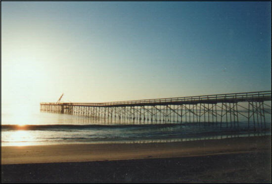
We rose about 6:00am behind the dune at Bechers Bay. I noted a lot of pebbles on the space
blanket that our sleeping bags were on. Thankfully, there were none in my ear. A quick look at
Gary revealed no crushed feet or skull.
So far the day was going really well.
I got out the stove and made my morning coffee fix and had a breakfast bar. At 6:30, we saw a
couple go out on the pier to get their morning paper. There was a beautiful sunrise over the
ocean, something you really dont see much of in California. The Snowy Plovers were on the
beach, making their familiar calls.
|
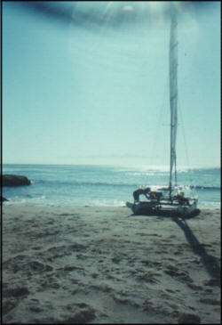
We broke camp and got ready to cross the Santa Cruz Channel once again; hopeful we would
find a suitable landing on Christy Beach. We left the beach at 9:20am, and had another smooth
day on the water, along with the east wind that the ranger had told us about.
The weather was continuing to be about as perfect as it could get: Sunny, smooth seas, and
decent wind. The easterly wind seemed to be flattening the seas even more than they already
were the day before. We were on course for the beach at Christy and this would take us right
past Frasier Point and the Forneys area. We spotted the same two fishing boats that were
working the area the previous day.
|
|
Suddenly we were haunted to realize that we were smack dab in the middle of the Potato Patch.
We knew we must have been having a good day when we would pass right through here without
flinching. The waves began to have white caps on them and we were not experiencing the 8-10
knots usually needed to produce white caps. Then we noticed that that waves were simply
becoming so steep that the tops were just falling off of them. Very Strange! It reminded us once
again of the haunted shack amusement.
As we got closer to Santa Cruz island, the wind clocked around to the south. Now we were on a
broad reach for Christy, and started heading up towards Canada de los Sauces just south of
Christy. This was our first alternate landing spot. We would now start at Sauces, evaluate it for
landing possibilities, then run northward along Christy Beach to do the same.
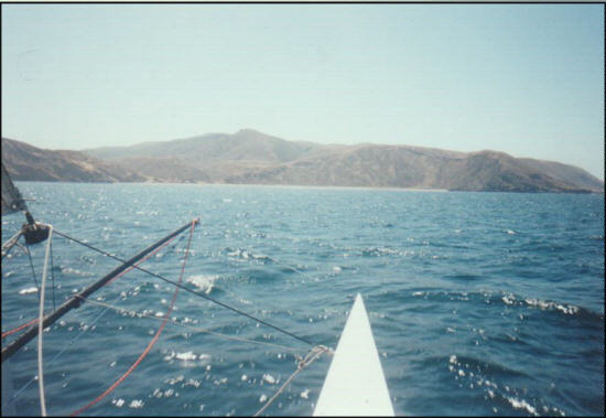
Once we got to Sauces, the place looked as if it had possibilities. However, once a good set
came in, it would look really rough. We hung around long enough to watch some wave sets and
didnt like what we saw.
We started our downwind run along Christy, and observed very turbulent seas and large rocks on
the south end, and a very steep beach with large waves at the center.
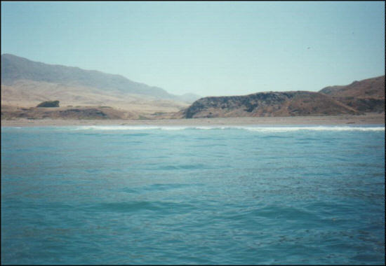
So far, I have not seen any place Id want to land on. How about you? asked Gary.
Me neither, I replied. Lets take a ride all the way up. I think the north end will be our best bet.
As we sailed down the beach, Gary brought us in real close to the surf line so we could look up
and down the beach to better view the size of the waves. With a concaved shoreline, you can be
situated behind the surf at one point while looking back at the breaking side of the waves on
either side of you. This allowed us to view the surf from the business end of it. They were bigger
than what we wanted to deal with. The beach to the south was far steeper than the beach further
north.
Once we got to the north end, we stayed to watch the sets. On the aerial photo, this was the
place that looked the calmest, and we were making the same observation now. After watching a
few sets, we decided it was doable, and would be easiest between the sets.
Gary decided to do a practice run for the beach. We also decided that if things looked good
during the practice run, we should go for the beach.
We came in at the very end of the beach, with some large rocks to our port side. As we closed in
on the beach, I looked behind us and saw that we were between sets. We were lined up pretty
good, and had some wind.
I think we should go for it, I said.
So in we went.
Is that kelp or a rock?!? Gary asked, referring to a large clump in the waves just off our
starboard bow.
Its a rock, I replied. A big one.
As we rode a wave in, our wind faded as it usually does in these places. The boat got about 50
feet from shore and stalled, then began to turn to starboard, putting the large rock between our
bows and the shore. I looked back and saw the next wave rolling in. In the next couple of
seconds, my mind started making an evaluation of the situation. The next wave was obviously
going to drive the boat over the rock and probably wreck it. I looked down and considered the
depth of the water, and whether I could jump in, stand on the bottom, and push the bows over.
The problem with judging depth at the Channel Islands is that the water is so clear. I figured it
was either 3 feet deep or 10 feet deep. In any case, staying on the boat was not going to do
anything to fix the situation. So I jumped in.
The water was about 3 feet deep. I shoved the bows around, past the rocks, and the boat washed
in on the next wave. Just one more close call, the count of which I have lost track of since we
started these trips.
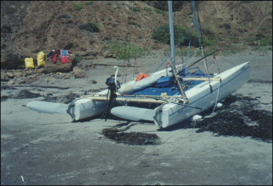
We got the boat up on the beach, switched to land mode, packed the pack back with food and
water, and started our walk to Christy Ranch.
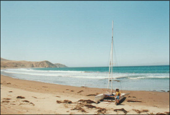
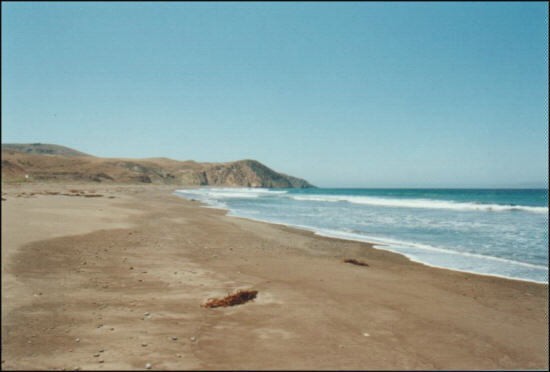
It was a beautiful beach without a single footprint on it. This place did not get many visitors. We
walked up to the center of the beach and made a turn up a running creek. Soon a ranch house
came into view. We got to a road and walked it up towards the house, gaining elevation over the
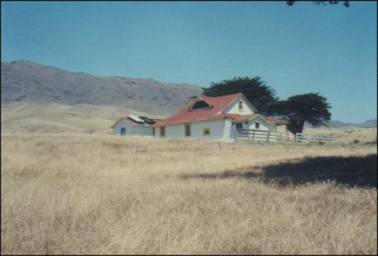
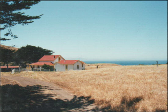
creek, which was now on our right. As we drew near, we found that the two-story ranch house
was a part of a spread of several buildings, all making up a typical ranch house with the assorted
outbuildings. There were two large barns visible from the road where we walked. There was the
usual equipment such as well, pump, electrical panel, tractor, and lots of rust and dirt. There
were a couple more buildings across the creek, and once we got to the ranch area we found a
small footbridge running over the creek providing access to them.
|
|
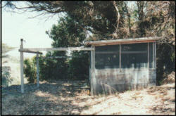
There was a small shack with a wrap-around workbench. All the walls were screened to allow
ventilation and to prevent flies and other pests. Outside the shack was a frame with hooks on it,
which appeared to be for hanging meat or perhaps the skins of animals. On the inside were
knives, sharpeners, a scale, and a few other butchers tools.
|
|
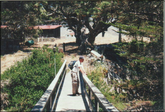
We crossed the bridge and heard the rushing water below. The first building was a set of
bathrooms with toilets, sinks, and showers. The next building was set up like a big boarding
house. It had a grand patio along side with a large dinner bell suspended aloft. The patio
wrapped around the west side of the house. This patio had a glass wall that acted as a wind
block. As I looked down the canyon to the beach and ocean below it became apparent that the
view from this location was one of the best natural views we had ever seen. Few people, if any,
were in the scene. The mountains, canyon, and beaches of Santa Cruz Island were in the
foreground. The Pacific Ocean and Santa Rosa Island were in the near distance, about 10 miles
away.
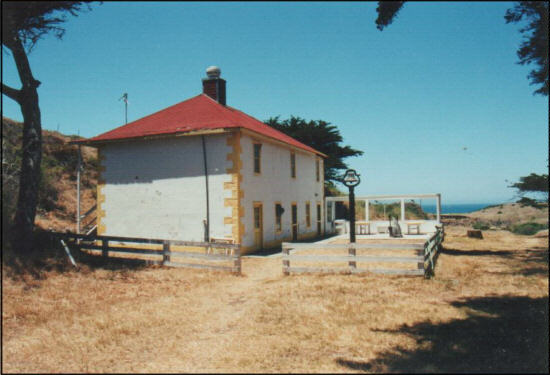
Looking through the windows of the building we saw a commercial type kitchen and a group
dining area that had a high ceiling and chandelier. There were stairs at the rear of the building,
which led to bedrooms, including one that is supposedly haunted. (See: http://www.ghost-
stalker.com/ghostgallery/ghstpix4.htm). Some of them were partially furnished, ready to
accommodate, while one of them was a loft that had been infiltrated by local birds and rodents.
The later would appear to have been servants quarters when the building was in operation.
This Servants room had access to both the upper and lower stories of the building, had a food
storage freezer (complete with dead mice and probably Hanta Virus), a small bed, and a nice
skylight, vent on the roof.
This room had close access to most everything in the house. It was close to most every back
entry from most every room. It was close to the storage closet, shower and bath rooms, front
entry walkway, electrical generator, river, bridge, patio, bedrooms, kitchen, dining room, garden,
butcher house, and any other place a building engineer would need to reach.
|
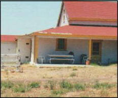
We crossed back over the bridge and went to the newer house. This house was of frame
construction, rather than Adobe, as was the previous building we visited. Inside was the usual
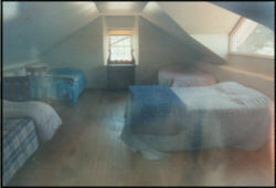
collection of furniture, including some antique four-poster beds in one of the bedrooms. There
was an outside stairway, which led up to a bedroom with beautiful hardwood floors and a large
picture window looking to the west towards the beach and distant Santa Rosa Island.
|
|
|
Next to the house was another set of bathrooms, and I used one of the sinks to wash my hands
and face.
There was a picnic table on a small covered patio at the front of the house, and we sat down to
have our lunch. It was surprisingly warm in this area, and was uncomfortable also. At once, we
were hiking again for the mile and a half walk to the landing beach.
|
As soon as we returned to the boat, we got ready to launch. The wave sets were coming in at a
respectable size, and we would need to launch between them to be safe. Then there was the
wind. When planning this trip, I saw only one advantage to this beach: The exposure to the west
would give us good consistent wind to land and launch, a rare occurrence anywhere else on the
island. Unfortunately, on this rare day, the east wind completely negated this advantage.
Since we were in the lee of the island, the wind was curving around it and coming up from the
south along the beach. It was hitting the cliff faces just to the north of us, then swirling around and
hitting us from that direction as we sat on the beach. As I looked out at the water, I saw we would
have wind from the north as we left shore, then it would switch to the south just outside the surf
line. Presumably, wed have no wind in between.
As Gary worked to start the motor, I continued to time the sets. We had 40 seconds of large steep
waves, then 100 to 120 seconds between them. Finally, at the end of one of the sets, we took off.
As I gave my side the final shove, I looked across to see Gary jumping up on the boat, and then
falling back into the water. One year ago, I had done the same thing at Laguna Beach on the
south shore, and Gary had rushed over and hauled my ass back up on deck. This would be my
chance to finally even the score! I started to spring into action just in time to hear Gary say, Im
fine, and jump right back on the boat. Damn
Maybe next time.
We sailed out in the northerly wind, and quickly hit the dead spot. Gary got the motor in the water
and powered us through the waves outside of the surf line.
We had completed our most hazardous part of the journey and could now claim that we had
effectively circumnavigated Santa Cruz Island by landing on every side on almost every
landable beach We started our long journey home, with the intent of landing on whatever south
shore beach we could make before sundown, preferably Coches Prietos, one of our favorite
spots. We made our tack across the Santa Cruz Passage to Santa Rosa Island, passing Skunk
Point and approaching East Point before tacking to the east.
The wind was now quite light. I looked out over the water and thought I saw some wind.
We should be getting good wind anytime now," I said.
Within minutes it died completely.
Nice job, said Gary. Bill opens his big fat mouth,
and everything turns to shit!
We both got a good laugh out of this line, which I think may be quoted for years to come.
Gary got the splash cover off the motor and lowered it into the starting position. After numerous
attempts it would not even try to start. The symptoms resembled an ignition coil problem that we
had encountered with another motor on a previous trip. Such a problem was not repairable here,
since we did not have the exact parts or tools to deal with it.
Gary sat back and looked at the motor in disgust, This thing is just dead weight now, he said. I
feel like unbolting it and throwing it overboard, right here.
I pictured Gary standing on the trampoline, and heaving the motor with both hands, only to have
the starter cord snag on his sleeve, starting the motor as he threw it, then hearing it run like a
champ as it flew through the air before splashing into the water and sinking to the bottom.
But neither one of us was in the mood for those kind of jokes at the moment. We were 45 miles
offshore, between Santa Rosa and Santa Cruz Islands, drifting north (stern first) at a half of a
knot of speed, in the current, with no wind, no motor, and 4 more hours of daylight.
We would be lucky to make Pozo (the closest Santa Cruz Island beach) by nightfall, and that
would probably be after hours of paddling.
We had the hooter sail up and were looking for any breath of air. After about 45 minutes or so, we
finally had some south wind we could use and started creeping our way towards the south Shore
of Santa Cruz Island. We decided not to heat it up too much, as that would take us further from
shore. We thought the wind could die at any time, and we did not want to have to paddle too far.
Within an hour, we had decent wind and were making good progress. If the wind could hold,
Coches Prietos might be a slam-dunk before sundown.
Weve got a problem here, said Gary, while examining the aft port corner of the trampoline. The
end of the bolt rope portion of the trampoline had come out of the track, as well as about 6 inches
of trampoline forward of the corner. As we put our weight on this portion of the trampoline during
tacks, or otherwise just moving around the boat, the problem would most likely get worse as the
trampoline continued to work out of the track. Basically, we were losing our deck. We decided to
stay away from the entire aft port corner of the boat, which would be a challenge for the skipper
during tacks to port. Also, given that we could spend hours on one tack, it would be easy to forget
about the problem. We decided that we would each remind each other by saying trampoline
whenever we tacked or had a reason to go near the problem area.
|
|
Just before Bowen Point, we came across a pod of dolphins that appeared to be feeding. Many of
them were jumping out of the water, some bringing their entire body up into the air. This is quite
amazing to see on the open ocean, especially from the low viewpoint of a beach cat. After
passing the pod, a giant adult that was about eight or nine feet long took huge jump and became
parallel with the waters surface when he was roughly six feet over the surface. He seemed to
float there for a long time. Gary speculated
|
|
that he was actually developing some lift, using
aerodynamics since he was moving at a pretty good forward speed and had situated himself into
an attitude of good posture.
We reached our jibe angle to Coches at 7:10pm, and made our turn north to the anchorage,
which was now about 2 miles from us. In the distance, we saw 3 boats at anchor. I was certain
we were probably drawing some attention coming in this late in the day on a beach catamaran.
Whisk was certainly a sight to behold. Making very good boat speed, under three large sails, one
of them powder blue, with the golden light that comes late in the day, over calm water, she
whisked us into the serenity of a beautiful lagoon. Just before pulling into the cove we doused the
hooter, and continued to sail straight onto the smooth beach. On one of the boats, there was a
man standing at the stern clapping. It was a slow, loud, respectful clap, obviously meant to
congratulate us. Gary tipped his hat and gave a quick wave at the audience.
We hit the beach during a set, getting hit with waves a bit bigger than I expected for this sheltered
cove. After rigging the rollers and hoisting system, we gradually moved the boat onto the shore.
The large waves were grabbing the rollers and pulling them out occasionally, so this landing did
not go as smooth as others.
The man who had applauded had boarded a Zodiac with 2 of his friends, and was on his way to
the beach.
Do you guys need a hand?!?, one of them yelled.
No, weve got it Gary promptly replied. Thank you very much, anyway.
|
Need a cold beer?
YES, he instantly answered.
The abrupt promptness, with the matter of fact seriousness of his
tone was absolutely comical! I then ran out into the surf so they would not have to land and get
wet.
This is an emergency situation! I yelled. We need beer badly! Now everyone was laughing.
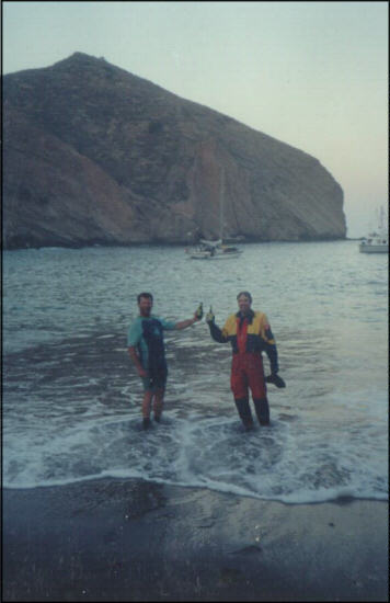
As I walked out into the surf, one of the guys handed me two ice cold Sierra Nevada Pale Ales.
The bottles were sweating and they looked as good as they would soon taste.
We thanked them profusely, and obviously showed our joy as we laughed out loud, toasted the
beer deliverymen, and drank our cold reward.
|
|
We were in the middle of nowhere, with no amenities whatsoever. But we had two ice-cold bottles
of beer in our hands!
When trying to lower the main sail, Gary was unable to get the ring unhooked, and determined
that there was a problem that would require us to capsize the boat. Capsizing would require that
we unload everything, and we were both a bit too tired to consider that option. The canyon walls
blocked the mild wind, so we decided to leave the main up for the night. The risk was that if the
wind came up, we would have to get out of bed to deal with it in the dark.
With the light beginning to fade, we quickly got changed and got our sleeping bags into position.
For dinner, Gary decided to make dinner from some various ingredients of food that we could use
up. We ended up with a stew made from Smokey Link sausages, celery, and beef stew. Pretty
darned good, actually. The fresh celery gave it a home cooked meal taste. After dinner, we drank
the last of the port wine, and went to bed a bit earlier than usual.

I never slept all that well on this trip, but remember I got my best sleep on this particular night. It
was bittersweet to be looking up at the stars and hearing the surf, but knowing this was the last
night of the trip. Gary was out, like a hibernating rock.
Day Four
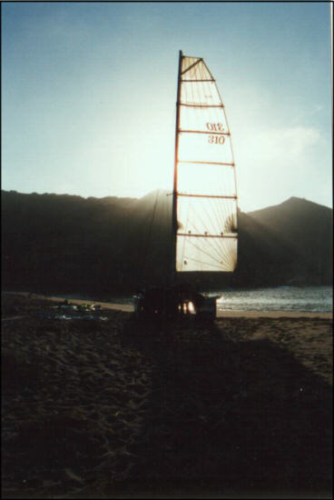
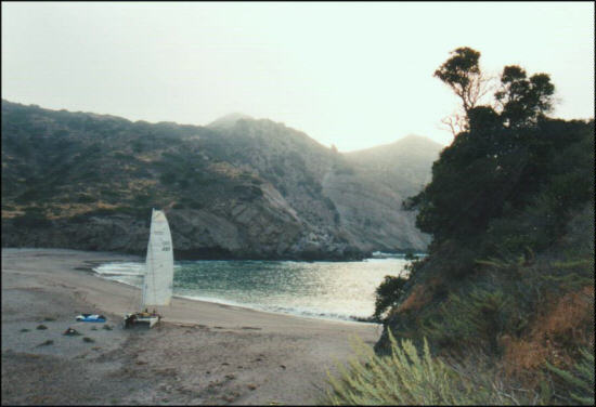
The next morning, I awoke to faint sunshine showing through fog. I got some nice pictures of the
scene including one with sunshine showing through the mainsail of Whisk, which remained
hoisted all night without a problem.
|
We discussed fixing the problem with the trampoline. Unfortunately, this would require a
considerable amount of work, since the trampoline would need to be removed from the boat. We
decided that we could live with the problem for one more day, and left it as it was.
A friendly couple, cruisers, came ashore from one of the boats anchored in the harbor. They
were going to go for a morning jog. The woman said she had seen our sails coming in from the
West. When I looked through the binoculars and saw the boat you were on, my jaw dropped to
my chest. Later, after they had left, Gary said, Id like to have MY jaw to drop to her chest.
Sailors
. Cant take em anywhere.
|
|
She also told us that we had missed quite a sight the day before. Earlier in the day, before our
arrival, there was a pod of Orca Whales and, they were in a feeding frenzy just outside the
anchorage. In all our trips, we have yet to see Orcas.
After the cruisers got back from their jog, we solicited their help in capsizing the boat and fixing
the halyard ring problem. They asked if they could help us get the boat launched, and we
welcomed that help as well. They even kicked off their shoes and got into the water to help us
shove off.
If there is one thing we have found to be consistent over the years of our visits to Santa Cruz
Island, it is the kindness and friendly nature of the people we meet there. There is a kinship
among those who visit the islands. The fellowship among strangers is unlike that of any other
place I have ever been.
Once we shoved off, we motored out of the cove and quickly got into sailing wind.
We took the first tack out far, past the east end of Santa Cruz Island, until the west end of
Anacapa Island was on our beam. Then we made our turn for home in the same spot we had
made our turn last year during our south coast tour. From there it was a single, 25-mile leg on
port tack for home.
We arrived at the Ventura Harbor dock at 3:00pm, and promptly called Shari our float plan holder
to let her know our trip was concluded. After 4 days on the water, we had returned just 4 hours
ahead of our scheduled return time.

After reviewing my notes and photographs of this trip, I have come to realize this was the best
sailing experience I have ever had. We accomplished all of our objectives and had outstanding
conditions in which to do so. With the Southern California coast covered with a much more
persistent than usual annual assault of the foggy marine layer known as June Gloom, we were
very fortunate to be treated to a weather window of opportunity that seemed to open and close
precisely synchronous with our trip schedule. All the time we were preparing for the trip, we
looked at gloomy days with little wind. Suddenly the skies opened up to shine blue on us during
the day, and shine starlight down upon us at night. Wind picked up enough to make for very
enjoyable sailing and rarely got strong enough to create anxiety. The only really adverse
condition encountered was the light wind on the third day, and that only lasted an hour or so. The
equipment held up well, and we didnt lose much of anything. Our provisions were more than
enough to get the job done, including the drinking water supply we had been concerned about.
Although the travel time on this trip spanned four days, the specific preparation for it started
months in advance. The experience, research, and equipment refinement actually started years
ago. This is one aspect that made this trip particularly rewarding; It was the culmination of years
of effort. Despite numerous points of potential failure, we pulled it off with only a couple of minor
hitches. Our only real regret was not ducking around Carrington Point on Santa Rosa Island and
making an attempt for San Miguel Island, the last island in the chain. This would have seriously
deviated from our plan, but we had a weather window we may never see again. On a positive
note, this trip left us with the impression that San Miguel is certainly doable. At the same time, I
cannot help but think how far we can continue to raise the bar before falling off.
Finally, I can never end one of these stories without offering my thanks to my skipper. Gary has
provided the boat, the equipment, and undoubtedly borne the majority of the monetary expense
of the trips in keeping it all in working order. Moreover, he brings skills and experience that make
him one of the most accomplished beach cat skippers I know. We trust each other, not only to get
the job done, but with our very lives. It has been one of my lifes best experiences to serve as half
of a truly synergetic team, where the combined potential exceeds the sum of the two potentials.
Perhaps the bar is not yet nearly as high as the potential will allow it to be set.
Bill Mattson
|
|


